Management questions
Note: This is a DRAFT version. For comments, suggestions or more details contact:
Bob Cottrell, Curator
Conway Public Library's Henney History Room
603-447-5552
cell phone 603-323-3359
search keywords
conservation
wetland
erosion
permission
safety
private property
security
trash
archaeological dig
Preservation issue
directional sign
graffiti
stolen
Eventually part of larger MWV Rec path
Whole project under Conway Conservation Commission
in conjunction with Upper Saco Valley Land Trust, etc. list stakeholders
Search this webpage for word conservation, culvert, wetlands, erosion (fix so only need to search conservation)
Conservation
An old industrial site, EPA review? Toxins in the soil? Water quality issues, test soil and water
Permission
Do we have, need permission from all landowners, to do this project?
Do we need that in writing?
coordination with all stakeholders and possible supporters
to do this project?
Do we need that in writing?
Conway Selectmen here.
Conway Conservation Commission here.
Conway Historic District Commission here.
MWV chamber commerce here.
NEMBA here.
NHDCR
NHDHR
NH DOT
NH Historical Society
NH Preservation Alliance
Ride noco here.
WM Trail Collective here.
Size, color and material for signs
The consensus from the Conway Conservation Commission is to have as few small signs as possible. Can we put qr codes on some of the posts that are there now? and use that format for most, all of the directional and interpretive signage (at least for phase one? we could add more signs later) see examples below:
trail logo and color scheme
could we/should we use the derrick logo as the trail logo?
colors could be red and green like the two quarries?
Maps
there are a number of interactive maps online
In some cases to access the maps you will need to create a free account with them.
Perhaps Larry Garland with the AMC could make a map like he has done for other sites.
The trails need more directional signage and perhaps blazing as well.
AllTrails map with elevations here.


trailforks maps (trailforks map redstone v010)
link to interactive online trailforks map here.

Parking
You can park on the side of the road around the triangle (need to confirm that this parking is ok)
From here to the "lathe house" is about 15 minutes. From the lathe house to the quarry is another 5 minutes with an elevation gain of x feet.

In this photo you can see one of the old buildings that served as a store for the Redstone community. More on this later.
x
A couple more images to show where to park, should we delete them? Can we post signs saying where to park and where not to park?


x
Safety issues
Private property issues
permission to explore this area? Can we get some of the trees cleared/cut?
Please respect private property as you pass through the village area.
Do an archaeology dig around here? Society for Industrial Archaeology?
first set of train tracks


show comparison photo this angle/view today
Below is looking "south" or "east" to the right
This main line runs to Portland Maine, a port of the Atlantic Ocean.
If you look carefully down the track you can see where the siding or side track meets again with the main track.


This line runs (or ws intended to run to (Ogdensburg? the Saint Lawrence? seaway, ck history and include maps of the period and today.
As a result, granite from this quarry could be sent by rail to a port and then shipped by sail and steam anywhere in the world.
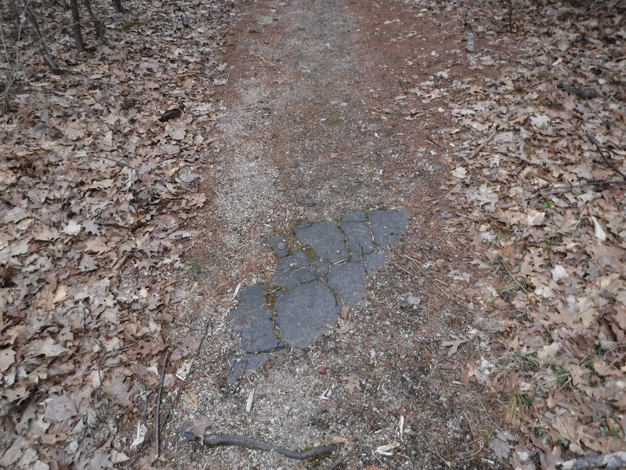
This sidetrack was a second set of railroad tracks was covered with asphalt leading into the trees on both sides

notice the cracks in the asphalt under which the train tracks are covered.
This was the "side track" or siding where train cars could be set aside so as not to stop the regular train traffic on the main line.


insert here about the houses and street names
location of church


info on Redstone Church from Hounsell, 196,
small non-denominational church built by I.C. Pert.
School

two room school, steam whistle
Eastern entrance gate

Walk around the gate. Be sure to carefully read the signs.
what are rules of parking here?
insert pic of car parking here

x

The road is paved for a while


We have had some theft and vandalism ...

x
conservation
add pic of the water retention here
Until it comes to a fork. Need directional sign here.
erosion issues around here


Trash
There is trash that should be removed (who would do that? when? how often?)


Swenson youtube video says this was for the office at 2 min 30 sec. See it here.
Should these debris piles be treated as an archaeological dig? Should that or any work in here be coordinated with the State archaeology dept? the division of historical resources? etc? Perhaps for the buildings the NH Preservation Alliance? Should we consider adding the site to the State and/or National Register of Historic Places?
Conservation
well on the side of the trail here
wetland, water quality


To the left just after the concrete structure for the tumbler and before the intersection/road that leads to the carpenter's building is a ditch feature that leads to more piles of metal, etc.


safety
conservation
wetland


Is this the forge from the tool sharpening site?


Just a short distance away
on the other side of the 4 corners, intersection
you will find NEMBA post number 41.
take a left here

x
Just a short distance away
on the other side of the 4 corners, intersection
you will find NEMBA post number 41.
take a left here


x

directing you to the Swenson trail and the outer limits trail to the right
x
other directional signs can be found on the trees themselves.
x

x
What to do with all the wire, metal remains all around?

and these wooden remains?

Could we/Should we, could we clear some of these trees to open up the views? perhaps through a timber cut?
Just down the road to the left are the remains of the carpenter shop.

Do an archaeological dig here?
The picture below shows more graffiti has been added since the previous visit.


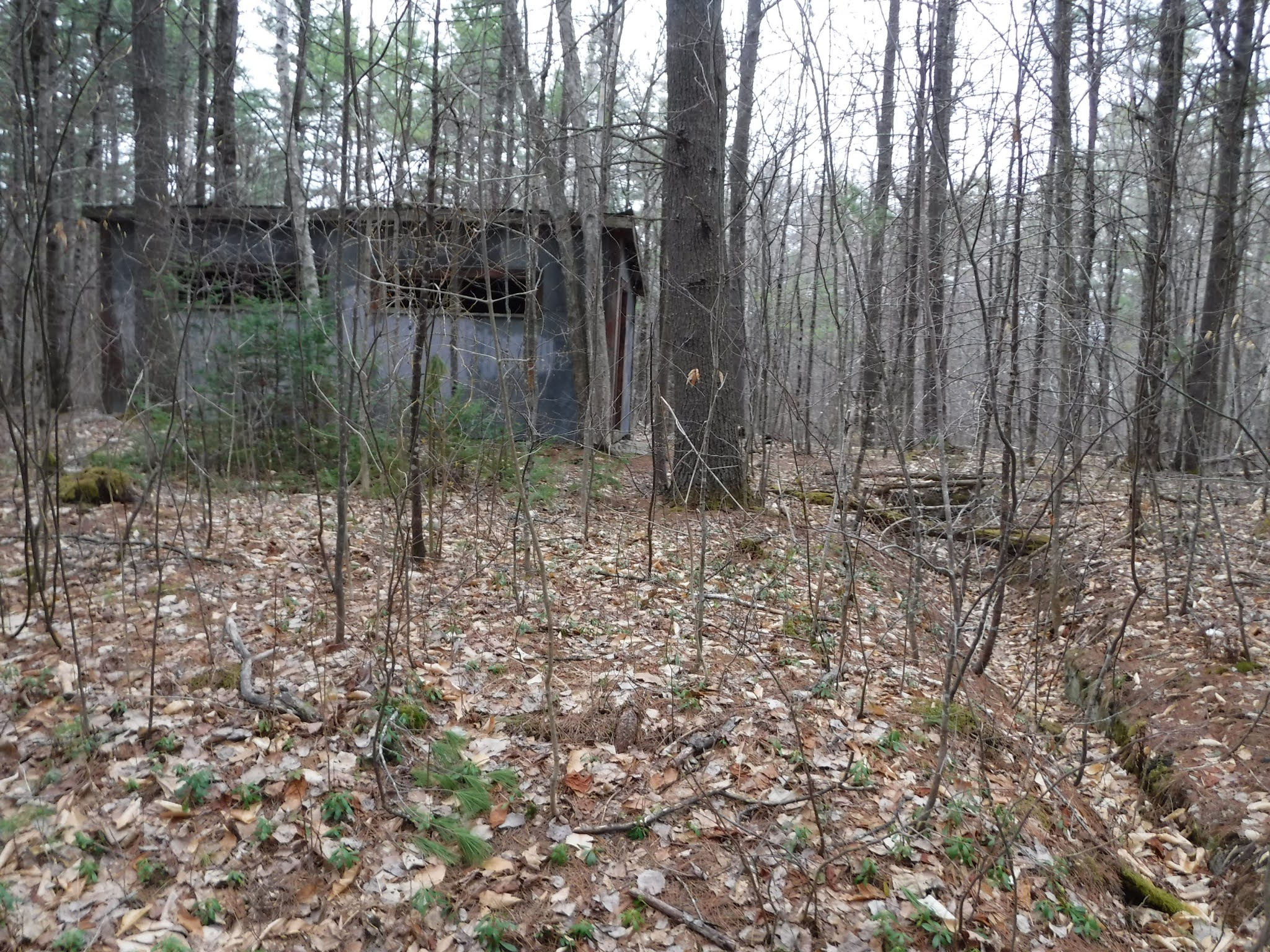
The "Carpenter Shop" a two story building with roof intact however seriously vandalized. Earlier photos show a handsome building which served many purposes including storage of supplies. Carpenters were important workers responsible for ongoing maintenance of many wooded structures as well as crating of finished stone work to protect it during shipping by rail.
As you approach the old lathe shed from post 42,


On the way you will pass the remains of an old derrick.

Preservation issue. How to preserve this derrick as it lays on the ground susceptible to humidity and rot, also exposed to the sky, rain, snow, etc.


x
You can see the image/icon of this derrick at the center of the yard on this map

As many as six different rail lines connected to the yard.
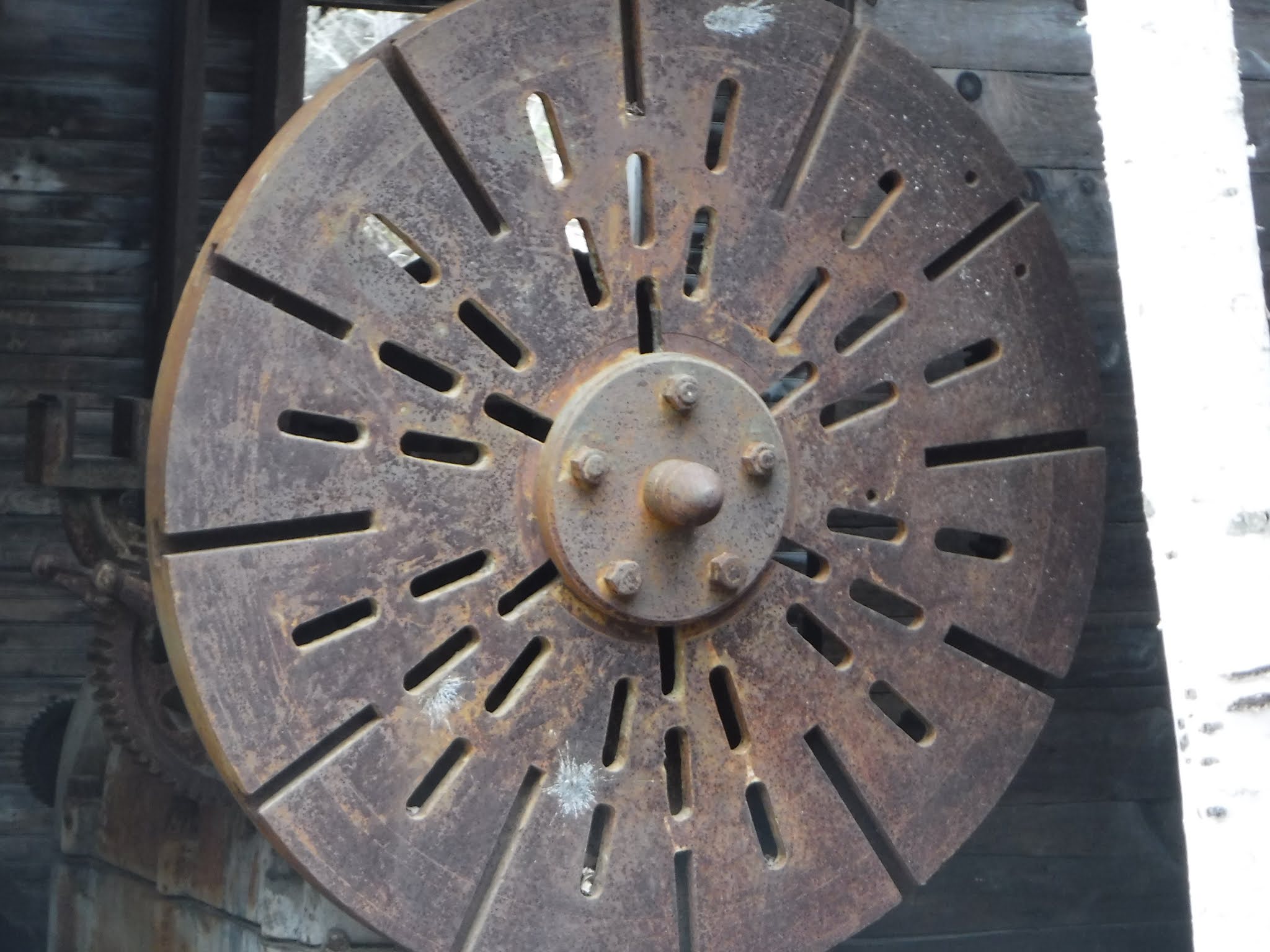
Here is the base of the derrick

Note the turnbuckles to keep the wires tight

add info even if not from this derrick, manufacturer and do that for all t&e, ck hagley, siris, etc. for info on manufacturers
Some of the derricks we will see came from the American Hoist & Derrick Co, St. Paul Minn, Chilled Derrick Patented Feb 4, 1913. Dsc00745

insert photos, map info, perhaps working model, simple machines, on how the derrick system worked.
Preservation issue
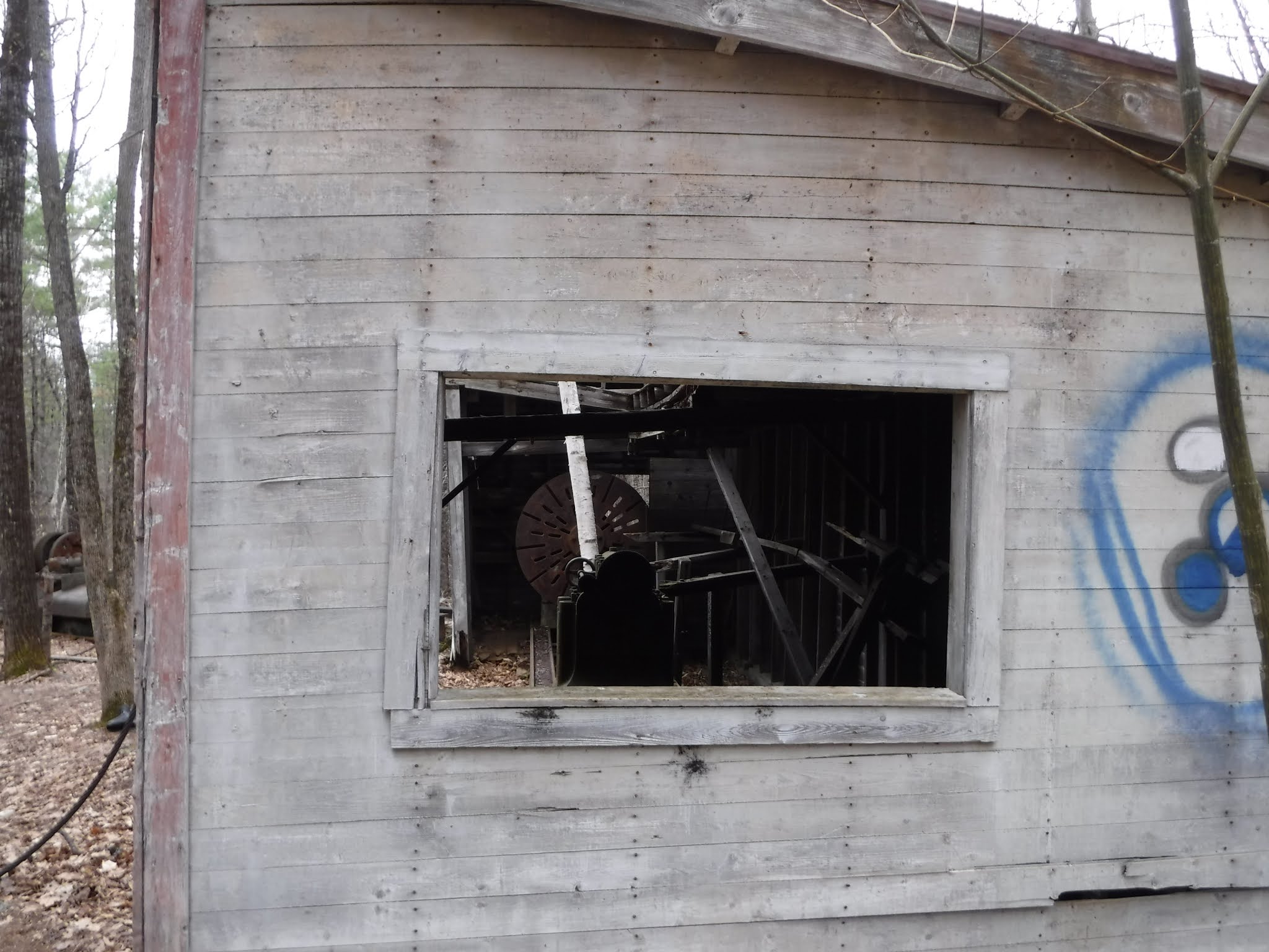
Yard area at the bottom of the one-way track from the green quarry. Multiple buildings were once here. Still remaining is the polishing shed with partial roof which could handle a column close to 19 feet long. No longer enclosed lies the large lathe which did the initial "roughing out" of a column prior to polishing. Columns were moved on slings hooked to a derrick and lowered in and out of the lathe building, thus the partial open roof remaining on the polishing shed.
Explore the Lathe building
How to preserve this building and it's contents? Should we contact NH Preservation Alliance and/or NH Dept Historical Resources, HABS/HAER for advice, support? It would be nice to have students do detailed photos and measured drawings, research on the companies involved, etc. Perhaps an archaeological dig?


x


x


Below before graffiti


x
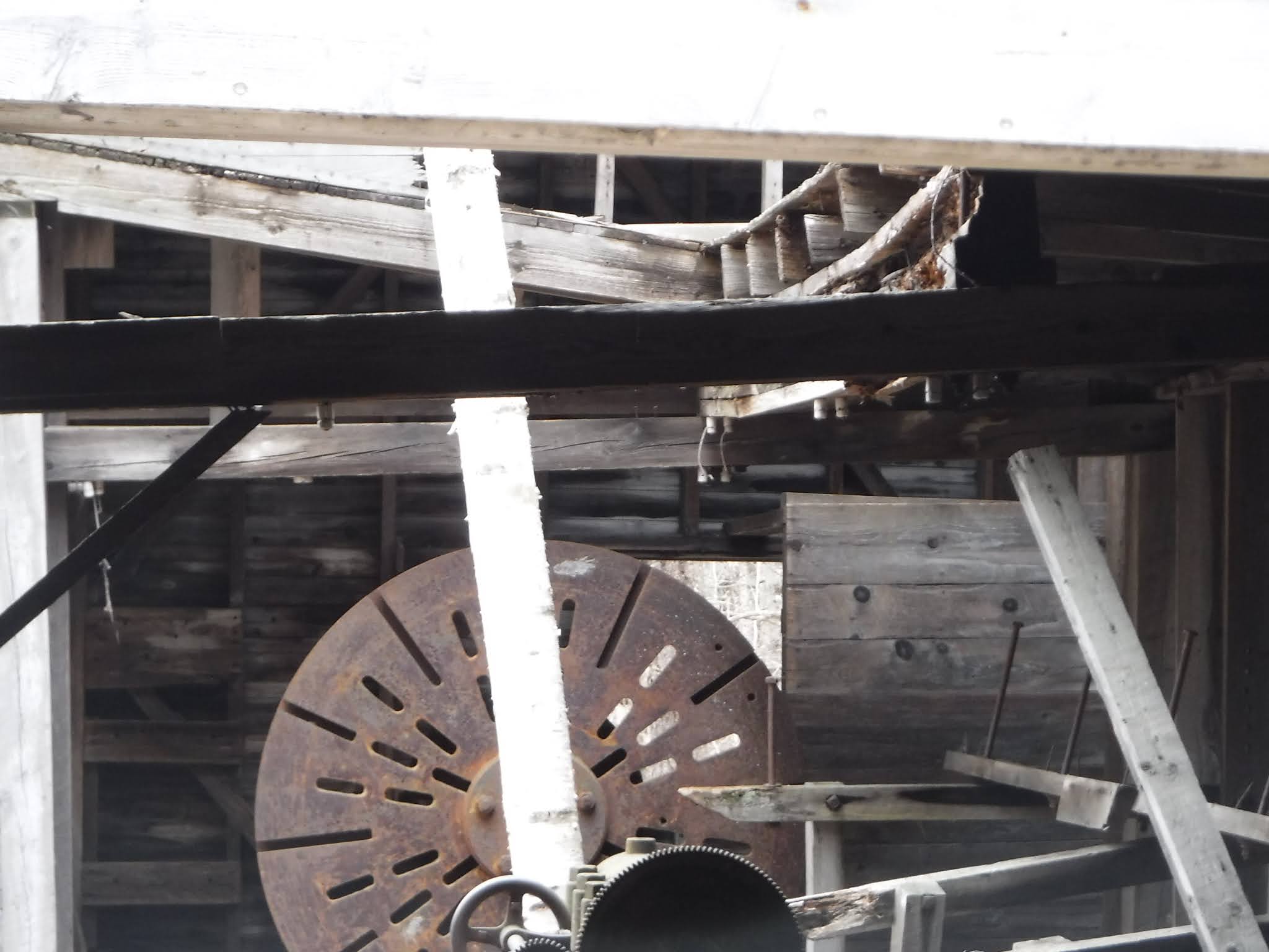
Now let's look at the lathe inside the building.
How it worked
Note: The sundial at the east entrance and the pilaster near the west entrance were turned on this lathe.
A tree has grown in the middle of the lathe cradle. Should we cut it?

leather belts were connected to the drive above.

Some of these belts may have been made at Page Belting Company in Concord, NH. Tie to NHDCR info if they have it. As of 2021 the company is still in business. See this link here.
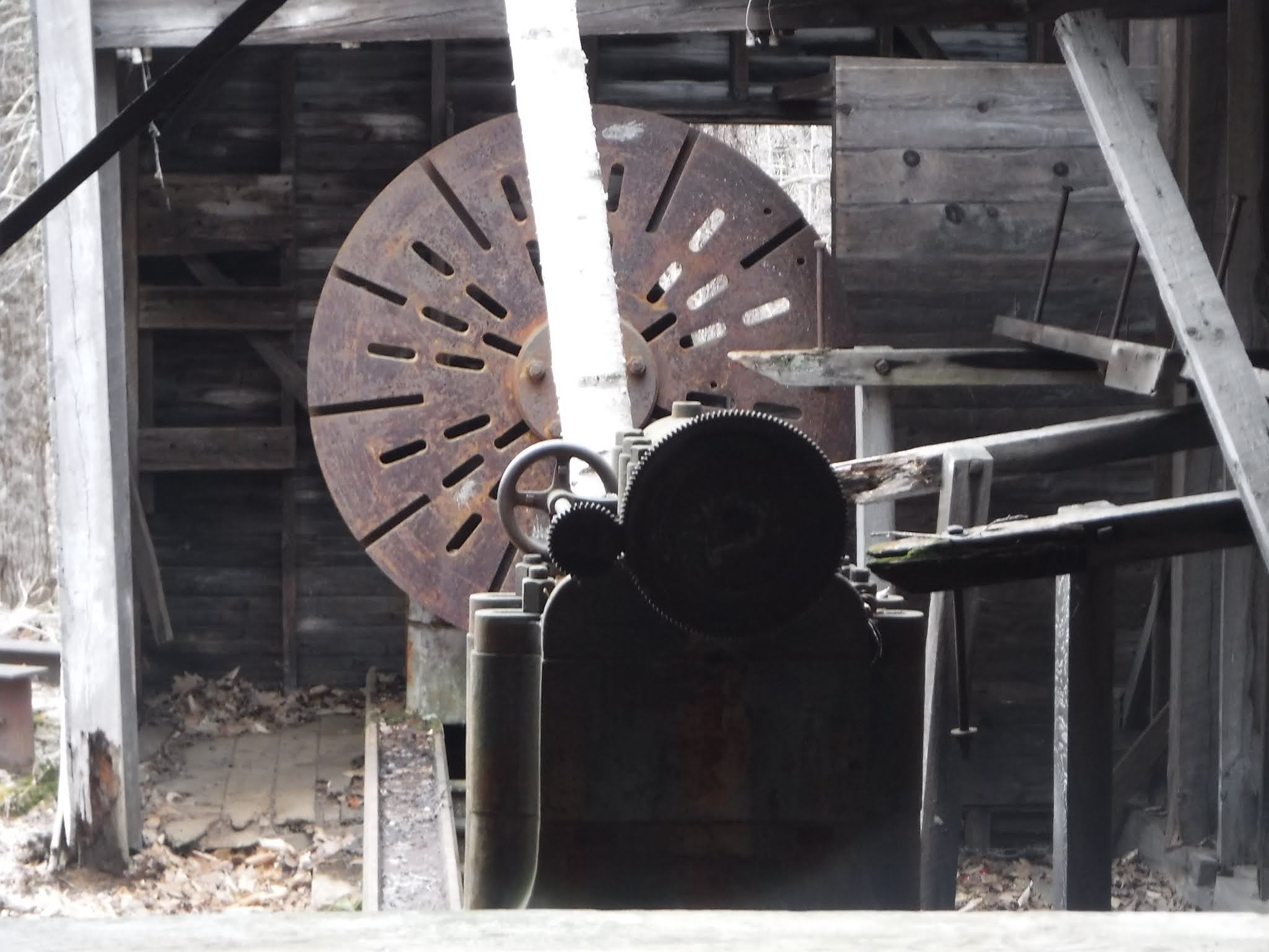
It was made by the Betts Machine Co. in Wilmington, Delaware

which photo is better?

For more on this company see this link here.
There is a second lathe outside.

x

x


x
If you take this path, On the right you will see several piles rock
conservation
erosion issue
on all elevation gains
added to by heavy mountain bike use


Then come to a T
conservation
erosion issue

Option B follow the narrow rail line from the lathe house up to the green quarry seen on the map below.
Soon it splits forks (we took the right, better to follow the left and take next right) need to photo these other trails later.

or should we build this trail safer? or both? as it does give good elevated view of the quarry
here is the trail we should take now as it is safer and easier from the crossroads


follow this curving path up the hill to the Green quarry
conservation
erosion


perhaps develop this as the main trail up and down?
see 11/21/2020 photos #3451 etc.
how to preserve this and protect provide safety to visitors?conservation
water quality

derrick and its "bull wheel" wetland protection, conservation

x
April 18, 2021 graffiti


x
Detour to the engine house, continue past to the right of it (behind it)
preservation issue


x

x

The Dela Vergne Refrigerating Machine Co. New York.
x

Take short detour on top of the "tailings" to view/overlook
the trail on the left here

along the way build barrier/s, coping? on both sides to define edges


along the way you will pass this

Then come to dead end.
safety issue

View ranges from large house on Birch Hill, on the left, Chocorua, then the peaks of the Moat Mountains and possibly catch a glimpse of the White Mountain Hotel at the base of White Horse Ledge.

compare with additional photos from today,

x
Heading down the hill
erosion issues
saftey issues


erosion


x
The back side of post 42 shows the Outer limits trail heads off to the left
The next stop after the quarry loop is the site of the old stone shed
Stone shed and blacksmith's forge with fire brick, parts of which have been stolen for scrap metal. The location is in the NNE corner of the original, 500 foot long, wooden stone shed. A cut guy wire from "Matron's" derrick is still visible on the ground while the two photos illustrate what was stolen for scrap metal (2012).
tool sharpening shed device on the right
was inside the stone shed

conservation
water quality issue
need clean up? oil residue?
x
x


The photo above by Joe Viger shows the stolen blacksmith forge and metal plates.
Is that forge actually over by the tumbler site?
see photo here from there
several views of the stone shed
dimensions
note the site was cleared of trees then
you could see the homes in the village from the stone shed

Here is view of the shed


Latrine on the left

Latrine building
conservation
drainage, erosion
need clean up
water quality from latrine?
safety

sawdust duct box? on the right


x
Now to the boiler room seen on the map below.

Two coal- fired boilers and two giant air compressor-steam engine flywheel combinations were originally enclosed within the same building. Boiler fronts are gone and a number of metal parts have been stolen for scrap metal. The boilers provided steam to power the engines which in turn drove the compressors that provided air for pneumatic tools in the quarries and stone sheds. The large air compressors, built by Chicago Pneumatic Tool Co., were installed in 1903 and 1905.


x

stamped "Governor 4"
x

stamped "Governor 3 1/2"
x

Stamped, embossed "Chicago Pneumatic Tool Co."

The photo below shows what the boiler plate or door would have looked like.

There are more metal items in the woods along here
on the right

on the left

insert photo of the gate here and the powerlines and open field you cross
x


Rejected, polished green column," pilaster", flat on one side, designed to go up against a building rather than to stand free. Reportedly it was to have been part of a structure at Grand Central Station, NYC. As recently as the year 2000 there was another rejected, round, polished green column lying nearby close to 17 feet long. It was cut in half in Ringe, NH for the Schiavi Co., owner at the time, and installed on the front corners of the Intervale, NH Post Office. The left hand column reveals an obvious seam which presumably was the reason for rejection.

Steve Swenson photo
Once you pass the pilaster, there needs to be some directional signage to lead you to the north kiosk and Hemlock Lane parking area.

There are a number of potentially confusing twists and turns here.

can we make this section of trail more straight here? it is kind of confusing when crossing redstone street on the way to the railroad crossing.
see trailforks map pillar to pond link here.

what kind of permission do we need to have folks cross the railroad tracks?
need a directional sign here
safety
an interpretive sign or qr code to a webpage could related the relationship of the railroad to the development of the quarry, see Hounsell, pp. 193+
what this pipe for?
conservation question? is it a well of some sort?

need a directional sign here


If you want to return to the sundial, redstone triangle, your car/starting point retrace your steps until you get to the intersection of Redstone Street
need street sign and directional signage here

From here it is a mostly flat trail/road about x minutes, x mile back to the Redstone triangle.
consider a culvert or bridge here? wetland protection, conservation


xyz