Note: This is a DRAFT version last updated 2023 10-20.
For comments, suggestions or more details contact:
Bob Cottrell, Curator
Conway Public Library's Henney History Room
603-447-5552
cell phone 603-323-3359
Outline of tour
Where (and why) is the Redstone Quarry
Split stone
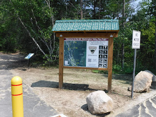
Welcome sign
Hemlock Lane Kiosk
Train tracks
Engaged column
Steam Engines
Latrines
Stone shed
Derricks and rails
Lathe House
Green Quarry
View
Red Quarry
Carpenter Shop
Redstone Village
Triangle Park
Flag pole
History written in stone
Bench
Sundial
Crossroads
For more information contact the Conway Public Library's Henney History Room.


.jpg)
.jpg)
Company Store
Boarding house
Airport
Further afield
Credits and Acknowledgements
To make the trip a circle, you can walk back from the Redstone Village triangle park to your car parked in the cul de sac on Hemlock Lane within a short time (ten minutes) along Redstone Road.
For a Valley Vision video tour from the Hemlock kiosk to the sundial see this link here.
You should allow about two hours for this adventure and 1 mile. Most of the trail is mostly flat and easy.
If you chose to scramble around the quarry it can add another x hour or more and become much more difficult with an elevation gain of x feet.
Be sure to follow all of New Hampshire's hike safe rules for details see this link. Check here to see if it is hunting season. Even if it is not hunting season, wearing hunter's orange is a good idea. At other times of the year follow guidelines to protect against ticks and insects.
We would like to thank the many people and organizations that helped develop this trail. Please see the credits at the end.
x
the signs can be found at this link.
click on images to enlarge them
right click on images to save them to your computer
x
start here at the kiosk
x
x
x
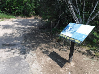
trail map

x
replace map below with most up to date contour with # and date updated
.jpg)
add updated directional signage map here
x
.jpg)
x

split stone
are examples nearby
add more?
curb here
There could be an interpretive sign here on tools
add bit here about hands-on explore tools at chs?
insert pics those tools and the marks they make
You can learn more about these tools by visiting the Conway Historical Society link their website here.
tool box owned by A.J. "Babe" Pinette dated 1932
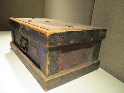
real name Pinette also drew the memory map we refer to here.
list some of his work records, etc.
x
A good description of the tools and techniques used to split granite can be found here.
first step to drill star drill that looks like this

You can see a video of that process here.
then insert feathers and wedges

then split

hope it splits straight along grain
insert from slide 42 stone splitting
why not able to copy?
then rough finish
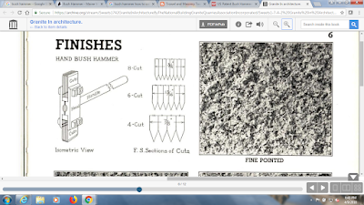
then series of finer and finer brush hammers
then finish tools for fine finish work

add more here


x

x
x

need a directional sign here to the crossing on the right

Turn left at the "alien" concrete barrier


If it is clear, look at the details of the raised letters on the rails.


Hounsell, pp. 193+
"In 1880, the attention of George W. Wagg was called to the fine quality of granite which was used in some bridges of Conway."
copy more from Hounsell p. 195 use this instead? or in addition?
"Somewhere between 1876 and 1880, there arose a need for stone abutments for three bridges in Conway... They were made of granite boulders lying handily at the foot of Rattlesnake Mountain. The ease with which this stone was split and handled excited the admiration of the stonecutters and it was not long before this came to the attention of George W. Wagg, general roadmaster for the Maine Central Railroad. He saw great possibilities in the stone because of its color and the fine luster it would take, too."
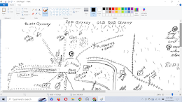
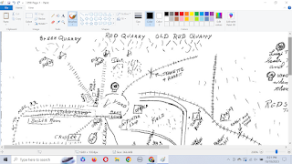
then map navigation, but also community, it is a memory map drawn by A.J. "Babe" Pennette. (check spelling, ask Ken Rancourt for more info on this).
The image below is a hand drawn map of the area. It can help you navigate through Redstone village and understand the industrial areas on the trail.


insert photos here of the path from the train crossing to NEMBA sign #39
x

x

x


x

x
x

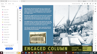
Rejected, polished green column," pilaster", or better description "engaged column."
flat on one side, designed to go up against a building rather than to stand free. Reportedly it was to have been part of a structure at Grand Central Station, NYC. As recently as the year 2000 there was another rejected, round, polished green column lying nearby close to 17 feet long. It was cut in half in Ringe, NH for the Schiavi Co., owner at the time, and installed on the front corners of the Intervale, NH Post Office. The left hand column reveals an obvious seam which presumably was the reason for rejection.

Steve Swenson photo

x
notice the holes in each end of the engaged column. Later on the trail we will discover the purpose for those holes and see the machine on which the column was turned, shaped.
x

x
Next you cross an open field with powerlines


continue following "Swenson" path

x
Not far on the left

then on the right

x

x
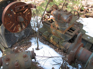
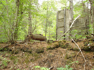
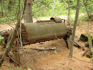
Now to the boiler room seen on the map below.


Two coal- fired boilers and two giant air compressor-steam engine flywheel combinations were originally enclosed within the same building. Boiler fronts are gone and a number of metal parts have been stolen for scrap metal. The boilers provided steam to power the engines which in turn drove the compressors that provided air for pneumatic tools in the quarries and stone sheds. The large air compressors, built by Chicago Pneumatic Tool Co., were installed in 1903 and 1905.


x

stamped "Governor 4"
x

stamped "Governor 3 1/2"
x

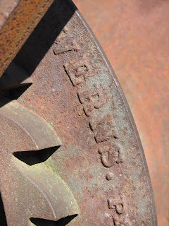
Stamped, embossed "Chicago Pneumatic Tool Co."

The photo below shows what the boiler plate or door would have looked like.

There are more metal items in the woods along here
on the left

Large CALIX core samples of green granite drilled prior to the last job furnished from Redstone in 1948 by the Swenson and Fletcher granite companies for an addition to the Criminal Courts building in NYC. Conway green granite was specified by the architect, quarried at Redstone and shipped by rail to Concord, N.H. and Milford, M.A. for final finishing by the Swenson and Fletcher companies respectively.
Three thousand and two foot core drilled in 1974-75 for exploration by the US Energy Research and Development Administration. The purpose was to evaluate the heat flow and geothermal potential of the Conway Granite. Secondarily to evaluate the potential source of uranium and thorium assocciated with the Conway Granite. Results did not warrant further exploration. However, there have been further speculations of potential geothermal sources within the Mount Washington Valley.
Three thousand and two foot core drilled in 1974-75 for exploration by the US Energy Research and Development Administration. The purpose was to evaluate the heat flow and geothermal potential of the Conway Granite. Secondarily to evaluate the potential source of uranium and thorium assocciated with the Conway Granite. Results did not warrant further exploration. However, there have been further speculations of potential geothermal sources within the Mount Washington Valley.
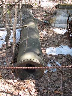
pipe in the woods on the right

sawdust duct box? on the right


Latrine on the right

Latrine building
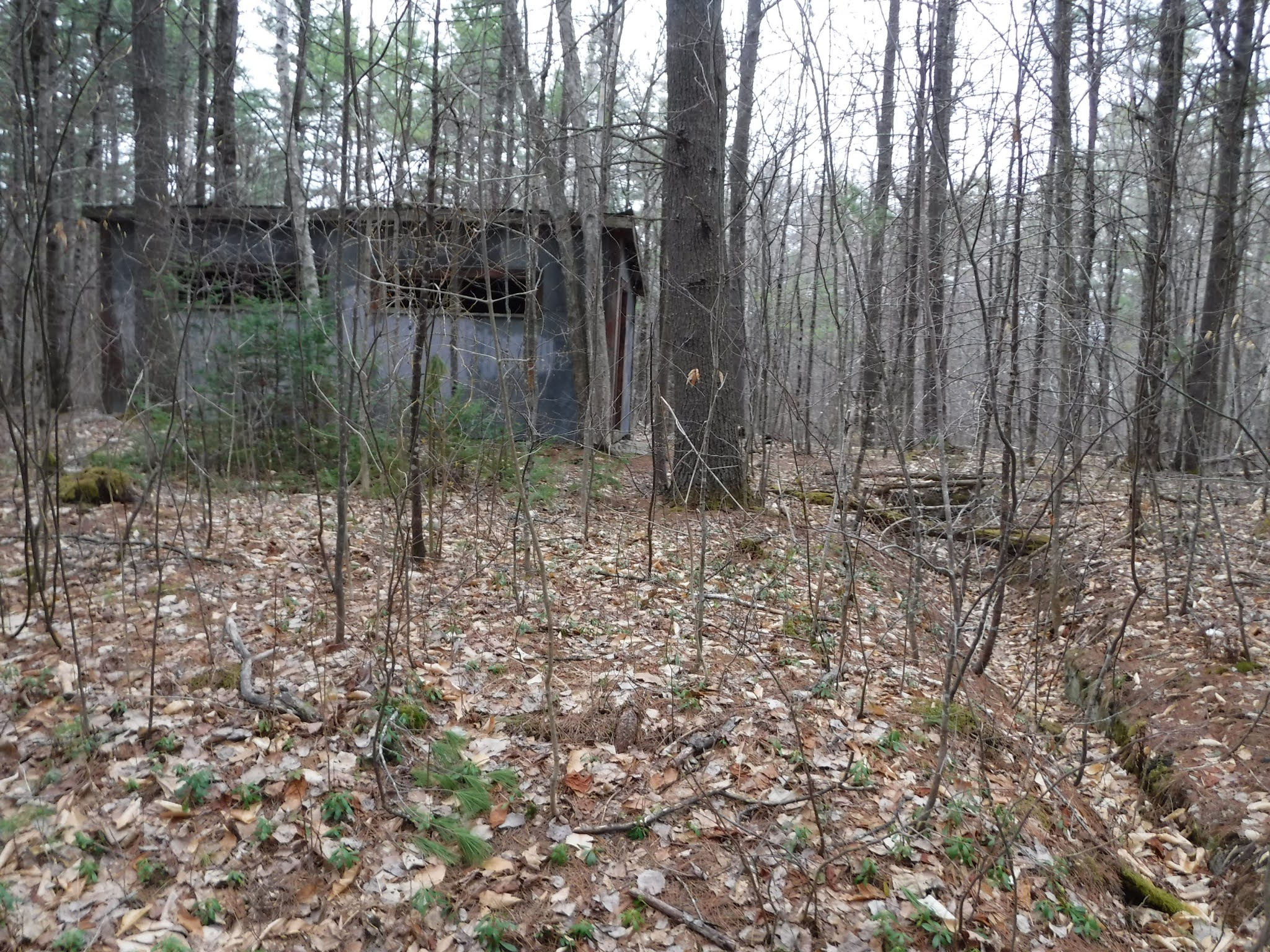

The next stop after the quarry loop is the site of the old stone shed
x

x
Stone shed and blacksmith's forge with fire brick, parts of which have been stolen for scrap metal. The location is in the NNE corner of the original, 500 foot long, wooden stone shed. A cut guy wire from "Matron's" derrick is still visible on the ground while the two photos illustrate what was stolen for scrap metal (2012).
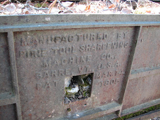
tool sharpening shed device on the right
was inside the stone shed
be careful of the open drain (this should be covered)

x

Notice the foundation wall for the wooden shed that was here that covered the tool sharpening station.
x
x
The photo below by x shows the stolen blacksmith forge and metal plates.

x
x
x
Manufactured by Pirie Tool sharpening machine co
Barre VT USA
Pat Mar 14, 1905
x
x

x
x
Is that forge seen above actually over by the tumbler site?
see photo here from there

several views of the stone shed
dimensions
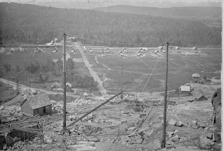
note the site was cleared of trees then
you could see the homes in the village from the stone shed

Here is view of the shed


MWM PSU collection

here see "back" side of the post 42 looking at the intersection beyond. Should be able to see from one sign post and/or blaze to the next so easy to follow the trail.

The back side of post 42 shows the Outer limits trail heads off to the left
x
post number 42.

From this post NEMBA 42 you can head up to the quarry site. This will add x time and x elevation gain to the trail.
Retrace your steps and return to the main intersection and continue straight ahead to post #42. directional sign
Perhaps add a directional sign reading "to the quarry" 5 minute walk, x feet elevation gain, with an arrow to the right could be added to this post on the empty face here.
From this post 42 you can see the lathe shed through the trees. Should we clear some of these trees?


x
here see "back" side of the post 42 looking at the intersection beyond. Should be able to see from one sign post and/or blaze to the next so easy to follow the trail.
The back side of post 42 shows the Outer limits trail heads off to the left

x

x
As you approach the old lathe shed from post 42,

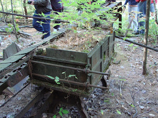
On the way you will pass the remains of an old derrick.
x

x
x


x
You can see the image/icon of this derrick at the center of the yard on this map
As many as six different rail lines connected to the yard.
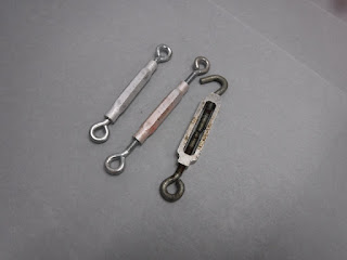
Here is the base of the derrick

Note the galvanized turnbuckles to keep the wires tight

add info even if not from this derrick, manufacturer and do that for all t&e, ck hagley, siris, etc. for info on manufacturers
x
Some of the derricks we will see came from the American Hoist & Derrick Co, St. Paul Minn, Chilled Derrick Patented Feb 4, 1913. Dsc00745

insert photos, map info, perhaps working model, simple machines, on how the derrick system worked.
x
x

x
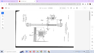
for patent see this link: here.
and slide 181 etc. 2018 11-05 Redstone Outreach slideshow previsit pine tree elem
x


Remnants of "Matron's" derrick, likely with a 90 foot mast and 80 foot boom, was strategically located and able to reach granite blocks coming from the two-way pink quarry tracks, the one-way green quarry tracks as well as any of the lathes. The base plat "socket" is obvious, the boom is mostly gone while parts of the mast remain along with the massive assembly of steel and ten guy wire attachments.
This massive assembly was on the top of the mast. Many of the wooden masts and booms were of Douglas Fur shipped on articulated flatcars from the Pacific North West.
Below is the top of the derrick.


x
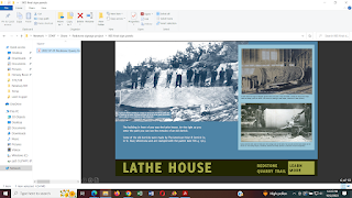
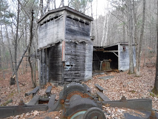
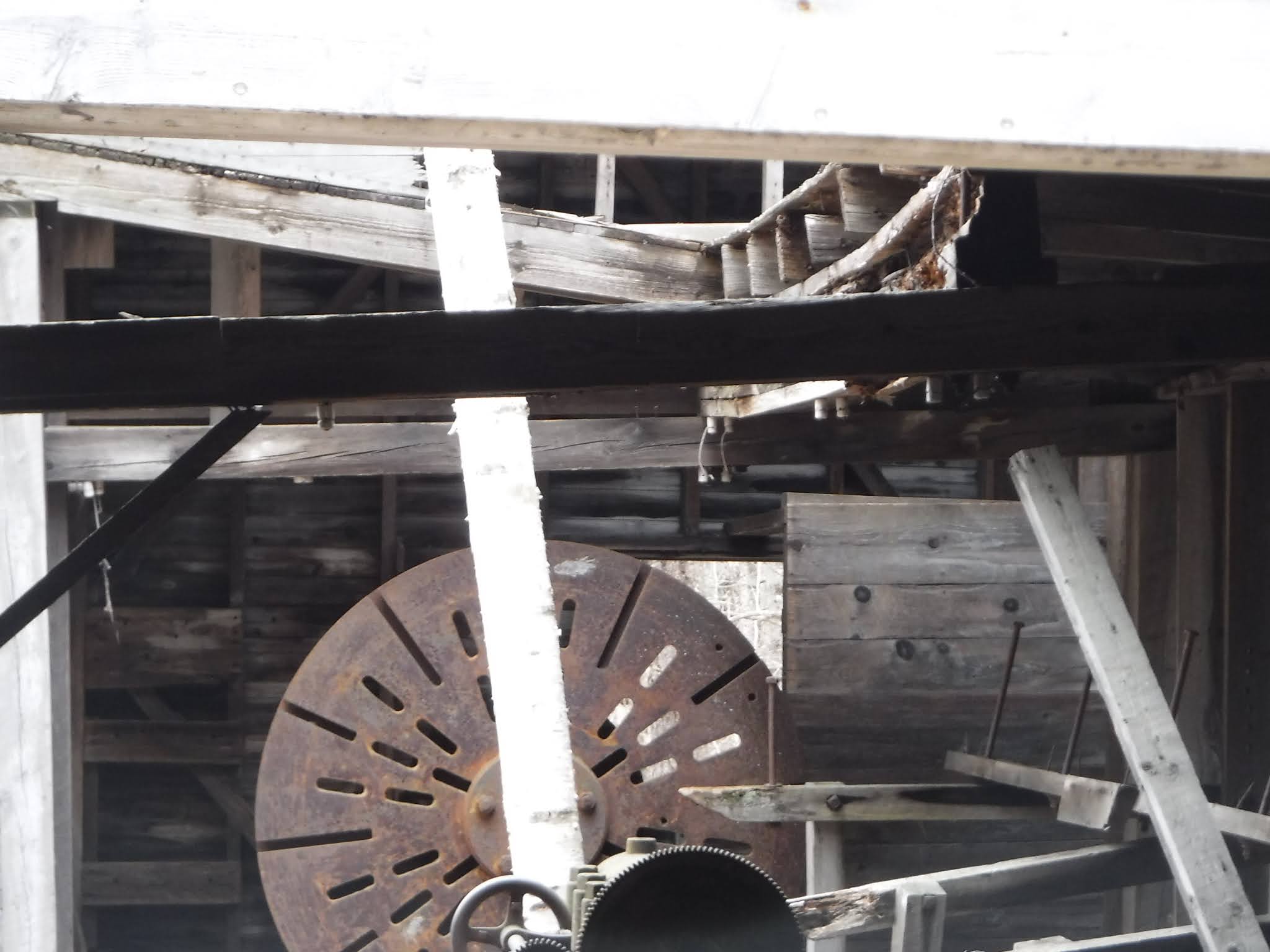
Yard area at the bottom of the one-way track from the green quarry. Multiple buildings were once here. Still remaining is the polishing shed with partial roof which could handle a column close to 19 feet long. No longer enclosed lies the large lathe which did the initial "roughing out" of a column prior to polishing. Columns were moved on slings hooked to a derrick and lowered in and out of the lathe building, thus the partial open roof remaining on the polishing shed.
Explore the Lathe building
How to preserve this building and it's contents? Should we contact NH Preservation Alliance and/or NH Dept Historical Resources, HABS/HAER for advice, support? It would be nice to have students do detailed photos and measured drawings, research on the companies involved, etc.
x
x
x


x

x
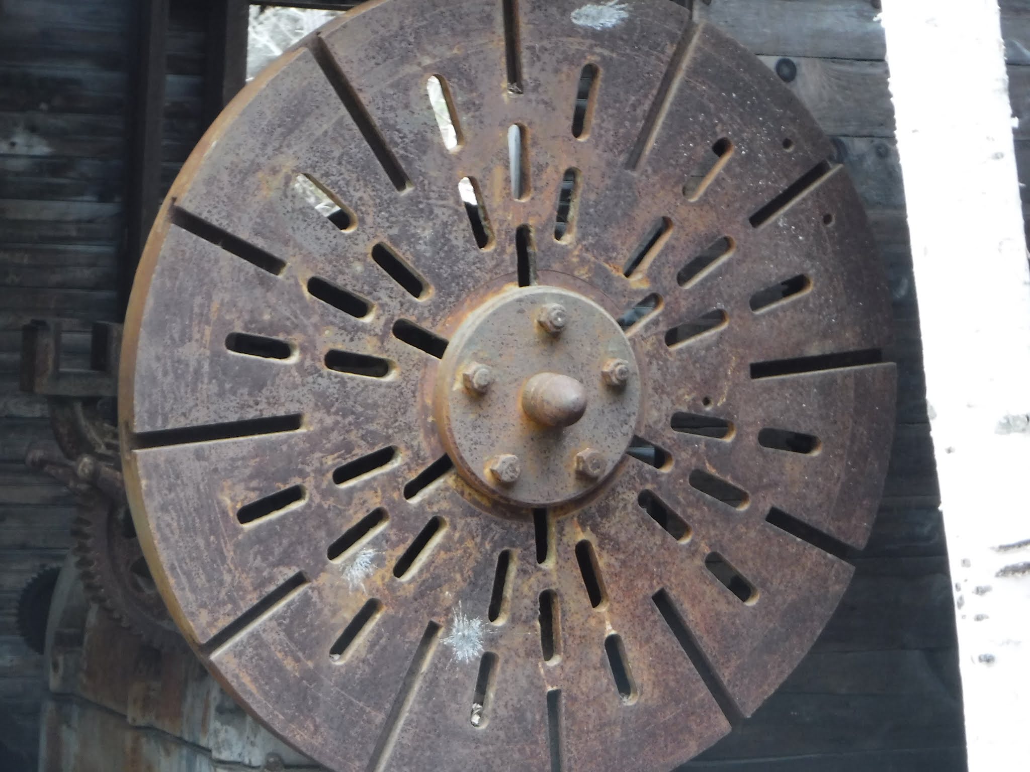
Now let's look at the lathe inside the building.
How it worked
Note: The sundial at the east entrance and the pilaster near the west entrance were turned on this lathe.
A tree has grown in the middle of the lathe cradle. Should we cut it?


x

x
leather belts were connected to the drive above.

Some of these belts may have been made at Page Belting Company in Concord, NH. Tie to NHDCR info if they have it. As of 2021 the company is still in business. See this link here.
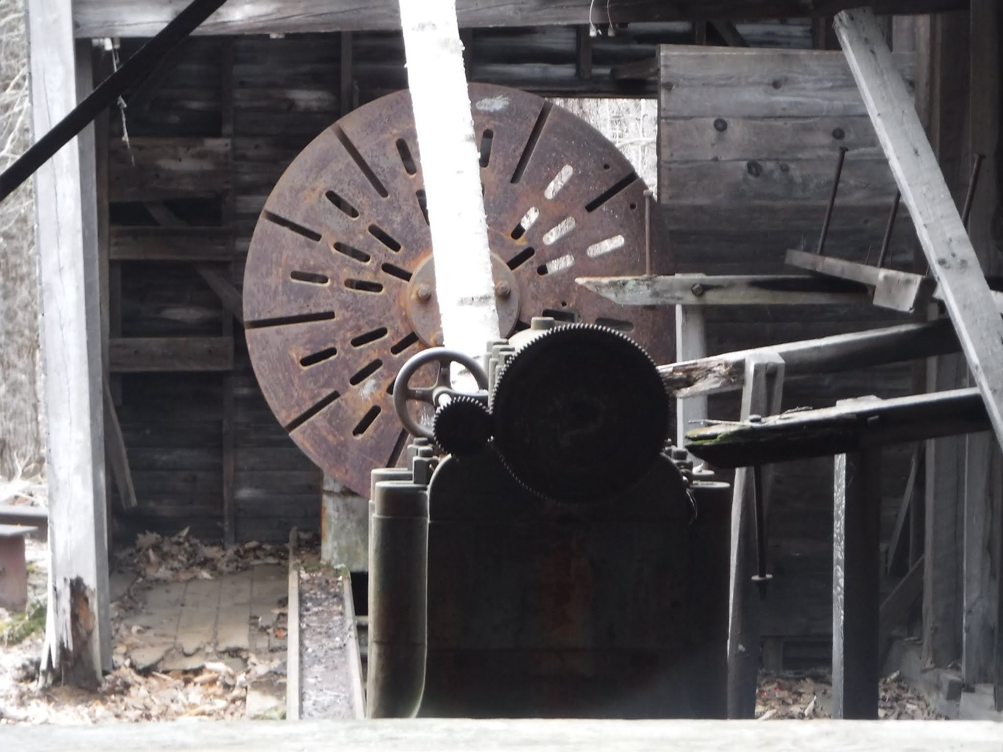
It was made by the Betts Machine Co. in Wilmington, Delaware

which photo looks better on a cell phone? click on images to enlarge them.

For more on this company see this link here.

There is a second lathe outside.

x

x

x
x
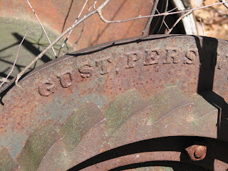
look for the manufacturer mark/label on the machine

Cottrell photo 3/27/22, DSCF0503
x
insert Desjardin photo showing the manufacturer mark here
x

x

F.R. Patch MFG Co. Rutland VT
research this co.
x
x
x

knuckle joints

x


How to explain these gears and gizmos?
x

x

x

x
Next you can head up to the quarry
describe the elevation gain, etc.
x
x
there are two options
suggest go up one and down the other?
x


x
x

x
option A take the wider road up

x
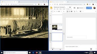
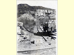
This is a historic photo showing the old rail line

You will be walking over the old train lines that ran up and down the mountain. Here you can see them before the trees grew in.
x
x
x

x
On this route you would walking up the rail that went to a derrick at a T on the edge of the red quarry, seen the picture above between the two large waist piles of broken rock and in the map below.


x
If you take this path, On the right you will see several piles rock


Then come to a T

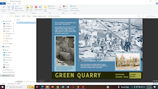
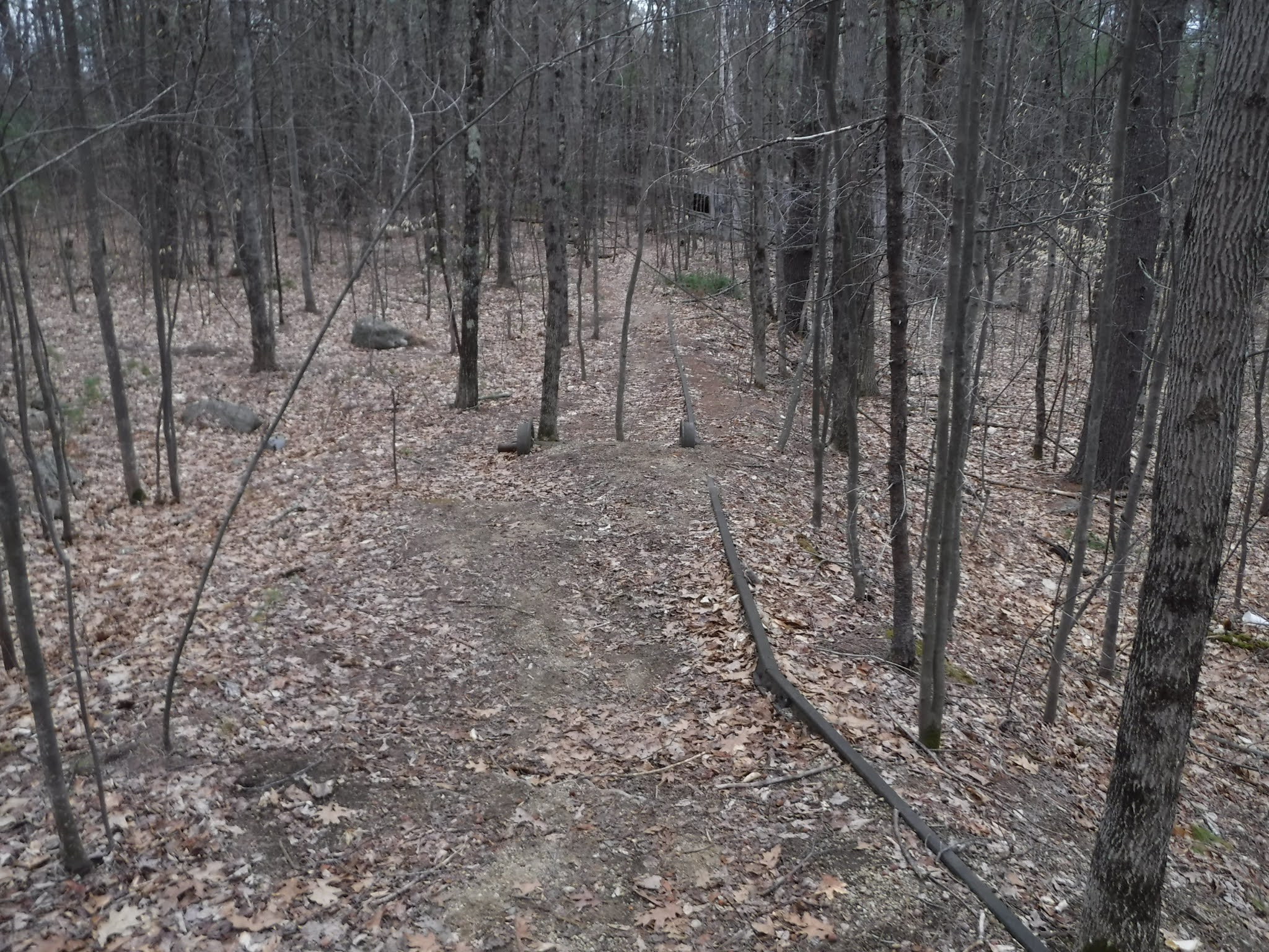
Option B follow the narrow rail line from the lathe house up to the green quarry seen on the map below.
Another option is to take the old rail line up to the Green Quarry
go around the back of the lathe house and find the rail line/track (fuji8279 +)
We could remove dirt so that the rail can be seen as in the map.


as you follow the tracks on the ground, follow the wires that go into the trees, literally into and through the trees. Actually you will see how the trees have grown around the wires
pic/s of that
x

x


x


x

photos from March 27, 2022
x

x
x


In April 2021 this old metal bedstead head board seen in the photo above was here.
And below another axle and pair of wheels were not far away in the woods leaning up against a tree.

x


need a directional sign here


x
go right here ,
Then come to a T
between is a big rock with graffiti (could put plaque on this)

The following section of the trail guide is a round trip detour to the red quarry and a scurry up to the ledge above.
Note: this is not recommended for inexperienced hikers. It can be risky.
As you move along this path, you will notice the subtle change in color of the stone from "green" to "red"

x

x

insert here about this scramble
And do a link to that whole video here.
https://www.youtube.com/watch?v=WPv_1Cl3vpw
6:06 drill holes and
6:13 and wedges
copy these pics as print screens and add to field guide
7:13,hairy climb, derrick pins?
7:30 derrick still there
7:35 great view scary climb down
8:08 see up from down
8:42 handle that still works on big rough lathe, parts face plate, tail stock
9:08 roof cut away so derrick can drop granite to the lathe
Then re-trace your steps and come back to the T and continue on what would have been the left path at the large stone
Soon it splits forks (we took the right, better to follow the left and take next right) need to photo these other trails later.

or should we build this trail safer? or both? as it does give good elevated view of the quarry
here is the trail we should take now as it is safer and easier from the crossroads
follow this curving path up the hill to the Green quarry


boiler


x
rivets

Walworth (NY valve company)

x

ladder against a tree
x
x
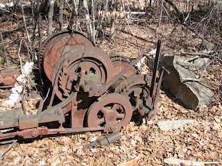
derrick and its "bull wheel" wetland protection, conservation

x
x
Green quarry, full of ground water, at the top of the one-way, winch rail line. Remnants remain of three wooden derricks, an engine house and "tugger" winch (1893) which retracted a rail car from the end of an extensive quarry dump. Parts of two derricks are obvious within the quarry hole while the third, "stiff-leg" derrick was higher up in the back SE corner of the quarry. When viewing the latter remnants one may note an excellent example of a "clovis" arrangement of hardware which is the anchor for a guy-wire attached to the top of a derrick.
x


x
x
to remains of engine house

perhaps develop this as the main trail up and down?
see 11/21/2020 photos #3451 etc.
how to preserve this and protect provide safety to visitors?
At the top you will find the remains of the main quarry operation.

x
How it used to look, how it looks now.


Engine house
looks like this now
x


x
used to look like this

picture of the remains of this machinery
match to the photo above
x

notice the pitman arm in the photo above
x


now go to the right, behind the engine house remains leads to a nice view, but don't go if you have vertigo,
x
fenway

x
Detour to the engine house, continue past to the right of it (behind it)
preservation issue


x
x
x
x

x

x

The Dela Vergne Refrigerating Machine Co. New York.
x

Take short detour on top of the "tailings" to view/overlook
the trail on the left here

along the way build barrier/s, coping? on both sides to define edges


along the way you will pass this

Then come to dead end.

View ranges from large house on Birch Hill, on the left, Chocorua, then the peaks of the Moat Mountains and possibly catch a glimpse of the White Mountain Hotel at the base of White Horse Ledge.

compare with additional photos from today,

x
x
Now go back to the engine house, and head along the path by the edge of the water
x
April 18, 2021 graffiti


x


Stamped American Derrick Co. St. Paul Minn.

cotter pin

back to this 4 corners

Now head back down hill to the sign post number x and
x


x
to the view
x
x

x


x

again,

x
Heading down the hill


Continue on and when reach the bottom and the 4 corners, turn right onto the main Swenson path/route/trail
post number 42.
insert quarry loop info and pics and map here
install safety warning signs here
rocks can be slippery
metal rusty and sharp can cut
From this post NEMBA 42 you can head up to the quarry site. This will add x time and x elevation gain to the trail.
Retrace your steps and return to the main intersection and continue straight ahead to post #42. directional sign
Perhaps add a directional sign reading "to the quarry" 5 minute walk, x feet elevation gain, with an arrow to the right could be added to this post on the empty face here.
Post number 41.

x
Just down the road to the left are the remains of the carpenter shop.

The picture below shows more graffiti has been added since the previous visit.


The "Carpenter Shop" a two story building with roof intact however seriously vandalized. Earlier photos show a handsome building which served many purposes including storage of supplies. Carpenters were important workers responsible for ongoing maintenance of many wooded structures as well as crating of finished stone work to protect it during shipping by rail.
Just a short distance away
on the other side of the 4 corners, intersection
you will find NEMBA post number 41.
take a left here


x

directing you to the Swenson trail and the outer limits trail to the right
x
other directional signs can be found on the trees themselves.
x

x
What to do with all the wire, metal remains all around?

and these wooden remains?

Could we/Should we, could we clear some of these trees to open up the views? perhaps through a timber cut?
You are following the old paths that many men worked along for over x years, since the 1880's.

Look at the map above to find the path you have taken from the school to the office.
The next structure you will come to the remains of the office
another Y forming a short cut to the lathe house
this then forms a triangle, but don't go there yet.

instead go left/straight come to a concrete structure, on the left.
continue of the left fork.

x
x
x

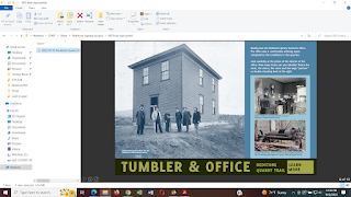
Swenson youtube video says this was for the gang saw and tumbler at 4 min 23 sec. See it here.
x
x

x
x

x
x


photo by x of stolen tumbler

business office
x

George Wagg on the left. Conway Historical Society 2018.262.001
x

Conway Historical Society 2018.263.001
x
add detail of this image with George Wagg, bowler hat
x
off in the woods near here


x
To the left just after the concrete structure for the tumbler and before the intersection/road that leads to the carpenter's building is a ditch feature that leads to more piles of metal, etc.


x
photo by x of stolen tumbler
Are these the same photos? perhaps photographer and collector?
x
continue of the left fork.
x

You will next come to an intersection of two trails.
be careful, be aware, listen, observe, fast moving bikes often move along these trails
share the trail
Need directional sign here at this Y.
a closer look at that previous memory map
More trash/debris


Swenson youtube video says this was for the office at 2 min 30 sec. See it here.
Should these debris piles be treated as an archaeological dig? Should that or any work in here be coordinated with the State archaeology dept? the division of historical resources? etc? Perhaps for the buildings the NH Preservation Alliance? Should we consider adding the site to the State and/or National Register of Historic Places?
x
Here is a picture of how the office used to look

insert picture of it from the inside too.
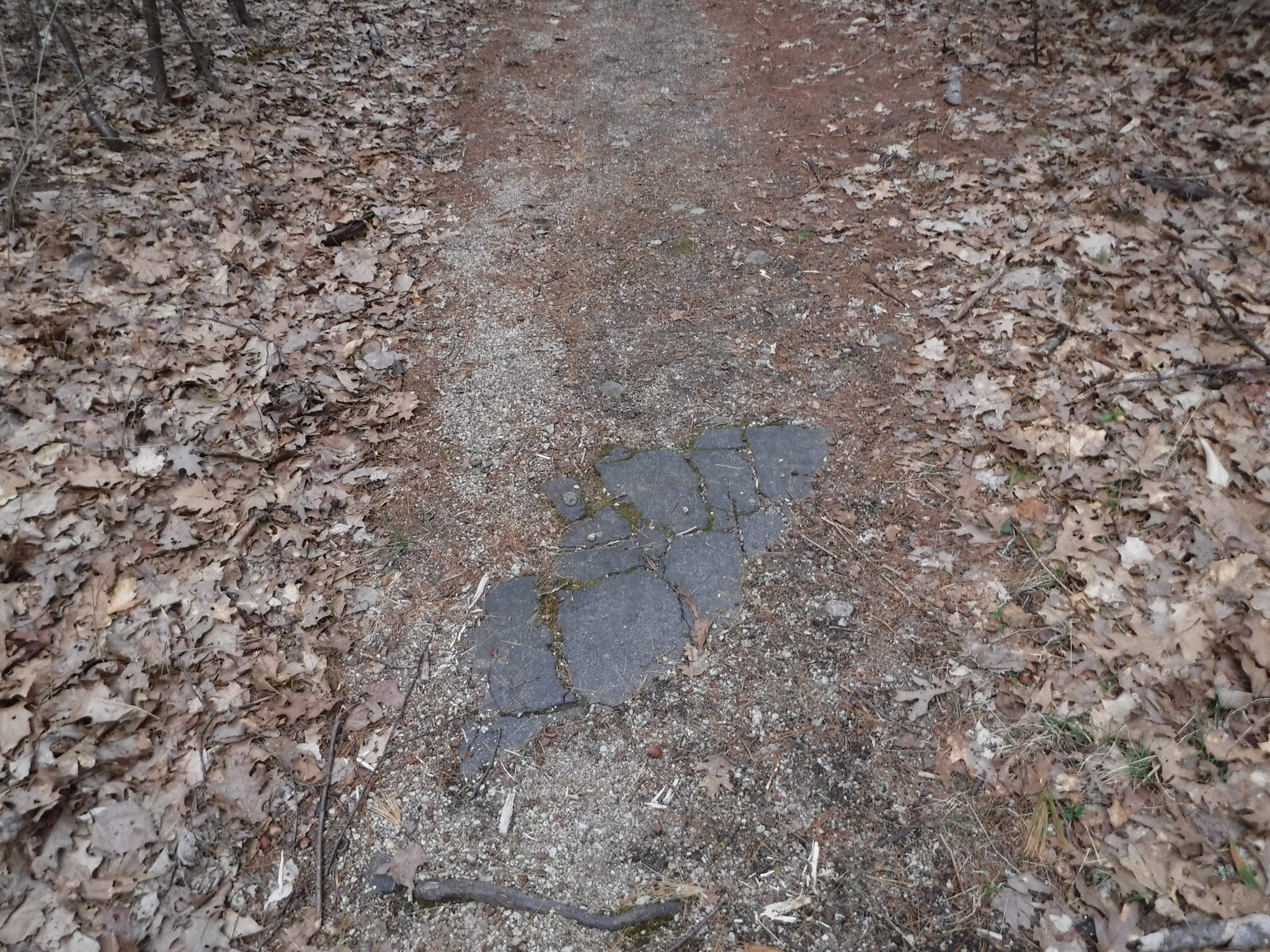
below can see remnants of when the path/road was paved.
x

x
There is trash that should be removed (who would do that? when? how often?)

x
Until it comes to a fork. Need directional sign here.


x
Follow the old paved road for a short distance until it ends and transitions to dirt roads.


x

We have had some theft and vandalism ...
The road is paved for a while

x

x
Eastern entrance gate

Walk around the gate. Be sure to carefully read the signs.
what are rules of parking here?
insert pic of car parking here

x

x

x
School

two room school, steam whistle
location of church


info on Redstone Church from Hounsell, 196,
small non-denominational church built by I.C. Pert.
insert here about the houses and street names
train tracks
This sidetrack was a second set of railroad tracks was covered with asphalt leading into the trees on both sides

notice the cracks in the asphalt under which the train tracks are covered.
This was the "side track" or siding where train cars could be set aside so as not to stop the regular train traffic on the main line.


Below is looking "south" or "east" to the right
This main line runs to Portland Maine, a port of the Atlantic Ocean.
If you look carefully down the track you can see where the siding or side track meets again with the main track.


This line runs (or ws intended to run to (Ogdensburg? the Saint Lawrence? seaway, ck history and include maps of the period and today.
As a result, granite from this quarry could be sent by rail to a port and then shipped by sail and steam anywhere in the world.
western set of train tracks


show comparison photo this angle/view today
an interpretive sign or qr code to a webpage could related the relationship of the railroad to the development of the quarry, see Hounsell, pp. 193+
"In 1880, the attention of George W. Wagg was called to the fine quality of granite which was used in some bridges of Conway."
copy more from Hounsell p. 195 use this instead? or in addition?
"Somewhere between 1876 and 1880, there arose a need for stone abutments for three bridges in Conway... They were made of granite boulders lying handily at the foot of Rattlesnake Mountain. The ease with which this stone was split and handled excited the admiration of the stonecutters and it was not long before this came to the attention of George W. Wagg, general roadmaster for the Maine Central Railroad. He saw great possibilities in the stone because of its color and the fine luster it would take, too."
Please respect private property as you pass through the village area.
Now you will head from the railroad tracks and enter the village area.


x
Flag pole

flagpole
x


at the base of the flagpole

then map navigation, but also community, it is a memory map drawn by A.J. "Babe" Pennette. (check spelling, ask Ken Rancourt for more info on this).
x
You will pass this welcome sign at the far end of the triangle area.
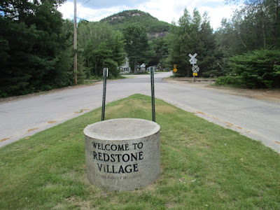
Look carefully at it's shape and the different textures of it's surfaces.
x


In this photo above you can see three different textures of stone finishing.
insert here or later about the tools that shaped the stone?
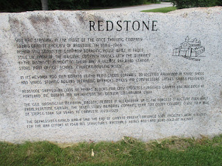
History written in stone
Just beyond the granite column are two slabs of stone engraved with some of the history of Redstone.

curb


engraved piece of redstone.

x
Notice the smooth, almost glass like surface of the stone.

look at the long drill lines on the end of the stone indicating the use of modern equipment.
x

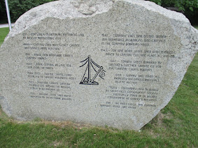
look at the different tool marks on this end of the stone showing evidence of yet a different tool.

x
green stone
greenstone
x

x
x

x

Bench
Just beyond the two slabs of stone the bench in the foreground here can tell us ...
while seems simple and straightforward, actually good lesson in stone
show marks on bench and then the tools used

x
Compare the smooth surfaces with the rough surfaces. Look closely for tool marks.


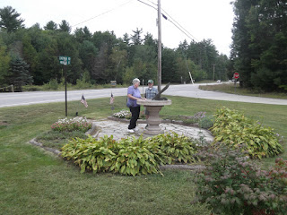
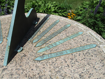
Sundial
x
x

The image below is a hand drawn map of the area. It can help you navigate through Redstone village and understand the industrial areas on the trail.
Here is a detail of the "triangle" section which serves as a veteran's memorial.
You can use some old photographs from the Conway Public Library's Henney History Room and other collections to orient your self in space and time.

sundial
x
x


Notice the base of the sundial is pink granite with a matte finish, that is then surrounded by highly polished/shiney green granite.
insert here pics of the names and the writing on the memorial
If you look at it from the angle below,

The item in the foreground is a sundial that commemorates the names of Redstone veterans from the first world war, 1917-1919.
For more veteran memorials in Conway see this link.
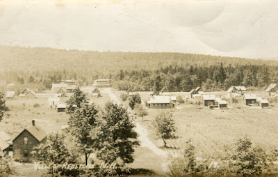
If you look beyond the monuments here in the triangle park, you can see the quarries cut into the hill beyond.
If you look at it from the angle below,
Here is what that view used to look like

You can see some of the derricks used to move the stone blocks around.
Here is a comparable view from today.

Here is a detail of that view


This is what to look for as you drive along Route 302 (near walmart?)
Here you will find the "Redstone Triangle" at the intersection of Eastman Road and Mountain Street. (what the best way to describe in words and illustrate in images how to get to this spot?
x
x
x
You can park on the side of the road around the triangle (need to confirm that this parking is ok)
From here to the "lathe house" is about 15 minutes. From the lathe house to the quarry is another 5 minutes with an elevation gain of x feet.

In this photo you can see one of the old buildings that served as a store for the Redstone community. More on this later.
triangle park
x
A couple more images to show where to park, should we delete them? Can we post signs saying where to park and where not to park?


Let's check out this sundial
careful observation, guided discovery, clues, evidence, history detectives
If you look at it from this angle you can see the sundial, the street name signs, and the historic building beyond which served as the store (more on this later).


This short, easy walking tour of Redstone starts at this magnificent granite sundial in the "triangle" park and heads northwest to another parking site at Hemlock Lane near Walmart. The trail is a small part of an extensive multiuse trail system.
While relatively short and easy, this tour provides an amazing number of interesting historical features (and views), and if you bike it, lots of action and adventure. At one time there were more than 350 men employed in the quarry operation here.
The first section of this trail guide shows some of the highlights of the trail. After that we get into quite a bit of detail for the planning and implementation of directional and interpretive signage. (until we see this picture above of a large stone sundial again).
(could a simplified drawing/sketch of this serve as a logo for our sign system?)
for directions, a map, location search see this link here.
x
community crossroads
x
crossroads

x

x
company store


x
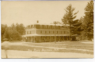
Boarding House
x

x
x
x
x
x
add airport
x
If you want to return to the Hemlock parking area from the sundial, redstone triangle, your car/starting point retrace your steps until you get to the intersection of Redstone Street
need street sign and directional signage here
x

x

x

x

From here it is a mostly flat trail/road about x minutes, x mile back to the Redstone triangle.
x
Then back to your vehicle on Hemlock Lane
insert picture
Further afield
To see more examples of Redstone Quarry products in the area, you can go to Intervale post office, Conway Historical Society,
x
insert picture
x

x


Credits and Acknowledgements
Written by Bob Cottrell, Curator, Conway Public Library's Henney History Room.
support by
Conway Conservation Commission
Conway Public Library
Conway Historical Society
Conway Historical Commission
etc.
add logos, Conway Public Library, Conway Conservation Commission, Town of Conway, Conway Historical Society, USVLT,
Museum of the White Mountains, PSU, Noel collection
etc.
Contributors and references
David Emerson
Janet Hounsell
Rick Russack
Steve Swenson
add Chuck and Cheryl, WeRmudfun couple
etc.